ÉPITÉSZET, GÉPÉSZET, KULTURÁLIS ÖRÖKSÉG, FILMIPAR
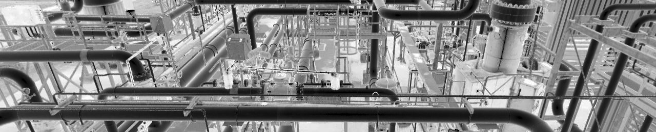
Munkánk során ötvözzük a különböző 3D felmérési technológiákat, megfelelve akár mikron pontosságú igényeknek is.Bármilyen ügyfél számára biztosítjuk a megoldásorientált kiszolgálást.
Számos jelentős referenciával rendelkezünk az építészet, gépészet, Building Information Modeling (BIM), gépipar, örökségvédelem, filmipar, reverse engineering területén.
Olyan 3D precíziós felmérést, valamint ehhez kapcsolódó szolgáltatásokat kínálunk, amellyel lehetőség van digitális modellek készítésére, felület- és környezetmodell kialakítására, utólagos nagy pontosságú vizsgálatokra és elemzésekre.